The Move to Earn (M2E) Sport Data Hackathon was a corporate competition focused on sport technology, promoting cross-industry collaboration and data altruism.As a product manager intern, I had the unique opportunity to represent H2U in this competition. I successfully advanced to the finalist stage and earned a Distinction Award along with a prize of 500,000 TWD.
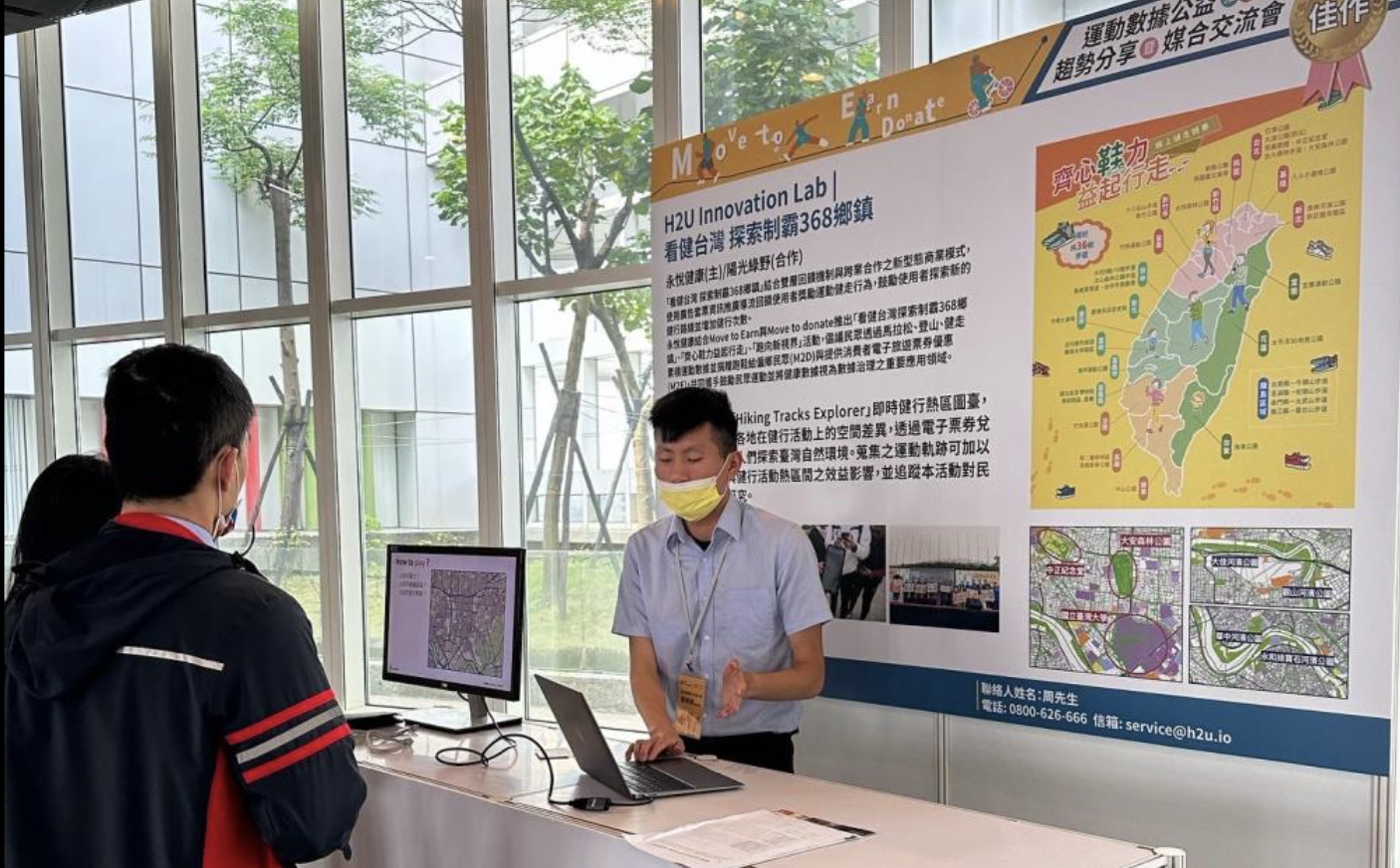
In an effort to promote outdoor activity and encourage data altruism, I organized a sport data hackathon that leveraged hiking app data to track users’ movements. This project, titled “探索制霸 368 鄉鎮” (Walking and Explore the 368 Townships in Taiwan), aimed to incentivize participants to explore different regions of Taiwan by gamifying hiking and walking activities. By rewarding users with travel vouchers, we successfully motivated them to venture into new areas and contribute valuable movement data for research.
The core of the project was a gamified movement tracking system. Participants could:
- Register on the event webpage
- Record their hiking tracks using the app
- Check their scores based on township exploration levels
- Redeem rewards using accumulated points
Each participant’s cumulative distance and township coverage were recorded, with scores assigned based on the variety of places visited. As users explored more diverse locations, they earned travel vouchers that could be redeemed for local attractions.
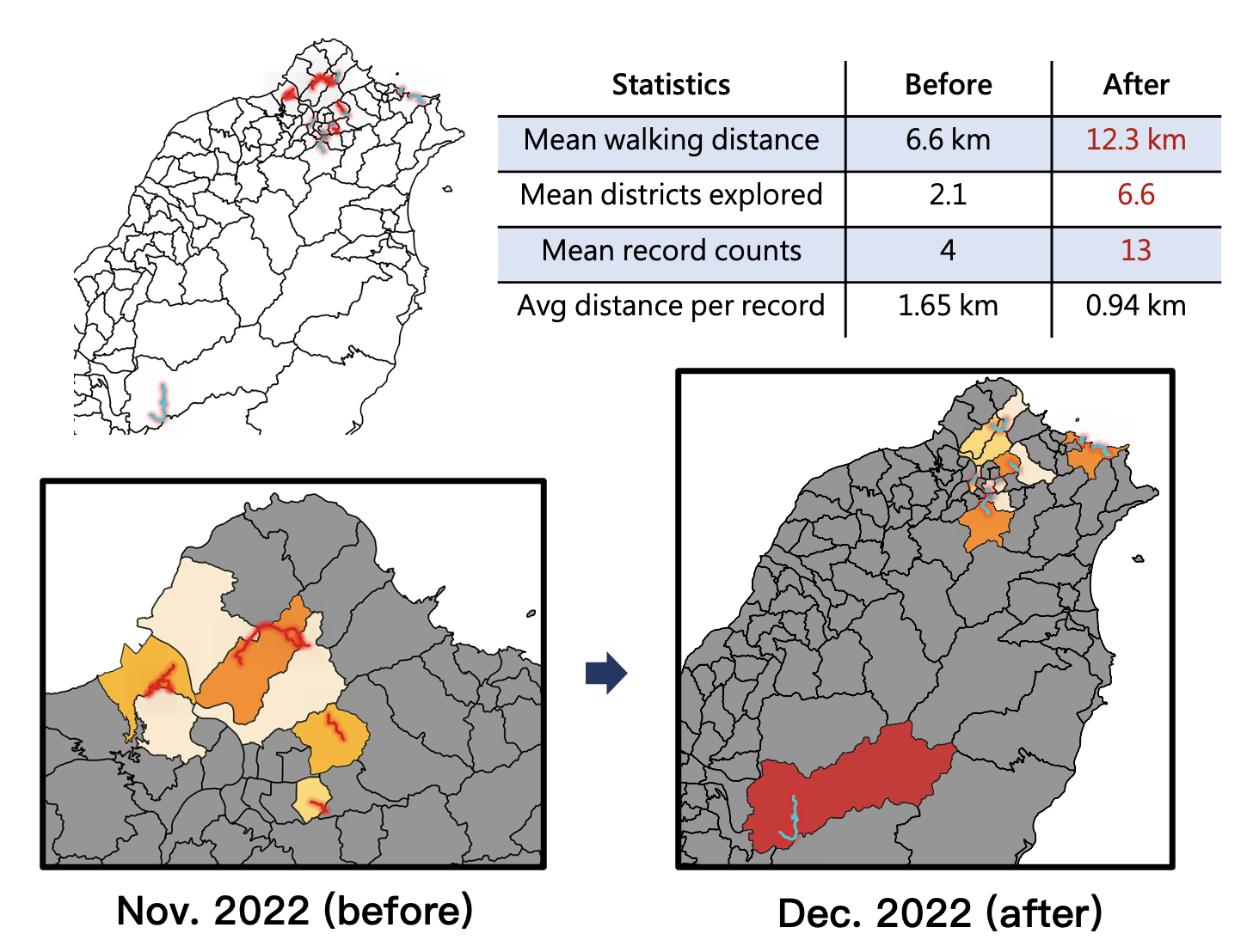 Comparison of participants’ walking behavior before (November 2022) and after (December 2022) the event. The statistics indicate increased walking frequency and diversity in explored areas. The maps illustrate how participants expanded their walking range, especially into southern Taiwan, after the event. This suggests that the event not only promoted hiking activities but also boosted tourism, encouraging users to explore different regions of Taiwan.
The event successfully attracted 16,988 participants, generating a total of 34,644 movement records. After de-identification process, the data were uploaded to the Sport Data Altruism Service platform to help research related to hiking behavior or sport science.
The collected data can be highly valuable for urban mobility and walkability research. By analyzing walking patterns, distance, and area coverage before and after the event, researchers can assess the impact of incentives on pedestrian behavior, identify walkable neighborhoods, and pinpoint areas needing infrastructure improvements.
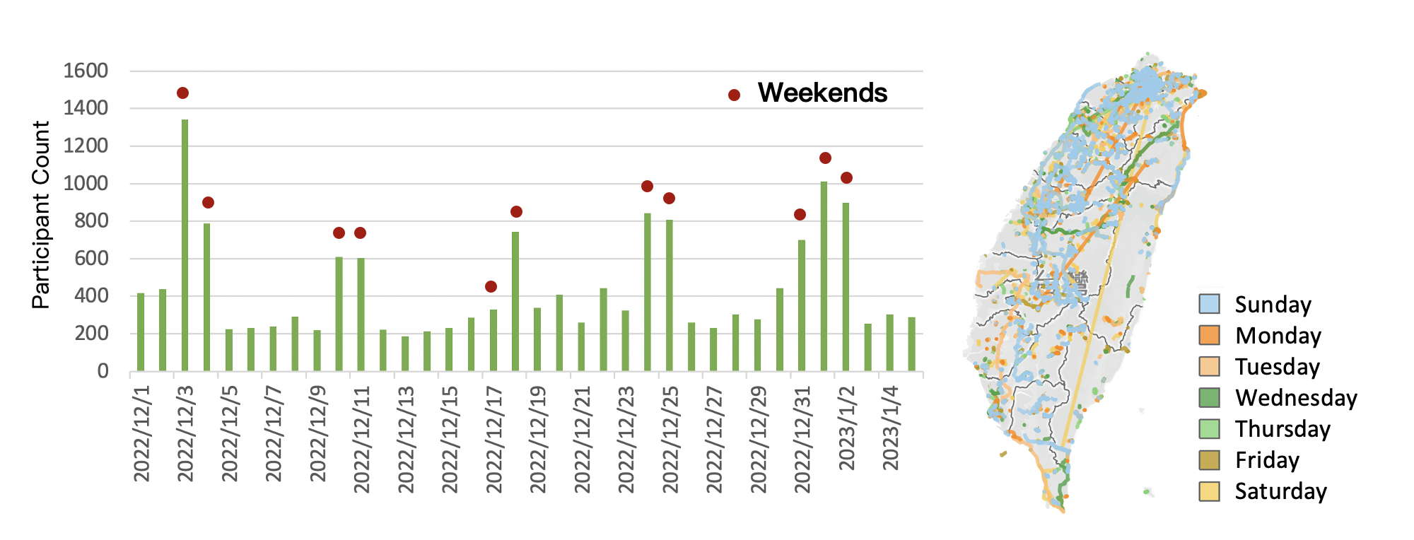 The overview of the collected trajectory data.
The data can also be used to analyze pedestrian flow and improve trail management. By identifying high-traffic areas, city planners and park managers can prioritize maintenance efforts to ensure well-maintained and safe walking environments. Additionally, irregular or looping trajectories may indicate areas where participants got lost or faced navigation difficulties. This insight can help in optimizing trail signage, improving wayfinding systems, and enhancing digital navigation tools to create a more seamless and enjoyable hiking/walking experience.
This initiative not only encouraged thousands of participants to explore Taiwan’s diverse landscapes but also contributed valuable resources for research purpose.
Would you be interested in similar sport data initiatives? Let’s connect and explore new ways to utilize data for public good!
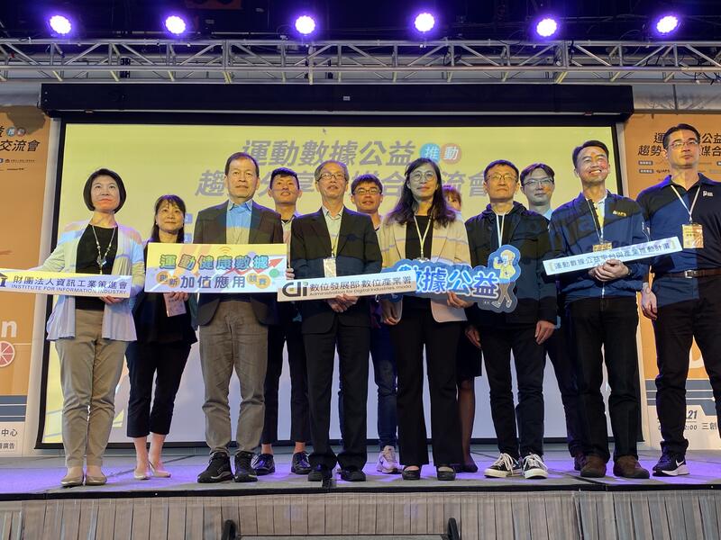 Press conference at the hackathon! I was honored to represent H2U and share our work with the public.